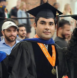


I am a Research Associate (Postdoc I) in NSF NCAR (National Center for Atmopsheric Research). Prviosuly I have been working as Postdoc Fellow in Environmental Remote Sensing and Water Security at Oklahoma State University, from August-December 2024. I served as a Graduate Research Assistant and Ph.D. student in Water Resources at the same institution from August 2021 to July 2024. I also had the opportunity to work as a Visiting Researcher at the Research Application Laboratory (RAL), National Center for Atmospheric Research (NCAR) in Boulder, Colorado, from May 2023 to January 2024. I hold a Ph.D. in Biosystems Engineering with specialization in Water Resources from Oklahoma State University, and prior to that, earned my Bachelor's (2016) and Master's (2018) degrees in Irrigation and Drainage Engineering from the University of Agriculture Faisalabad, Pakistan. Additionally, I spent two years (2018-2020) as a Ph.D. candidate at the Key State Laboratory of Digital Earth Science, Institute of Remote Sensing and Digital Earth (RADI), University of Chinese Academy of Sciences (UCAS) in Beijing, China, gaining valuable research experience
Dr. Arfan Arshad
Postdoc Research Associate
NSF National Center for Atmospheric Research (NCAR)
Boulder, CO 80301, USA
https://orcid.org/0000-0002-0726-1807

Research
As an Environmental Remote Sensing/ Ecohydrologist /Water Resources-specialist my long-term research vision is to promote food and water security in global emerging regions by providing place-based water management solutions with the help of ground-based, space geodesy (e.g., GRACE, radar altimetry), and remote sensing datasets in combination with land surface models (e.g., Noah-MP, VIC), hydrological models (e.g., SWAT) and data-driven machine learning development tools. My goals are to advance monitoring, modeling, and assessment of the fundamental hydrological and atmospheric processes, and environmental water management problems over a wide spectrum of spatial and temporal scales. I am further working in the following areas of specialization:
-
1. Watershed modeling and climate change: Visualizing the Impacts
-
2. Flooding and Drought Risk Assessment
-
3. Watershed Scale Surface and Sub-surface Water Storage Monitoring
-
4. Remote Sensing & GIS Applications in Earth System Studies
-
5. Top-down Downscaling to Enhance the Spatial Resolution of Grided Datasets
-
6. Digital Image Processing for Agricultural Cropping Systemes
-
7. Improve understanding of agroecosystem-environment interaction
-
8. Land-Atmosphere Interaction Studies
-
9. Climate System Modeling


