top of page


Mountain Watershed Glacio-hydrology
Pixel-based Groundwater Depletion Model for Sub-surface Hydrology of Irrigated Basin
.png)
Groundwater Droughts Monitoring with GRACE Satellite Data

Data-driven Spatial Downscaling to Improve Satellite Precipitation Estimates for Distributed Hydrology

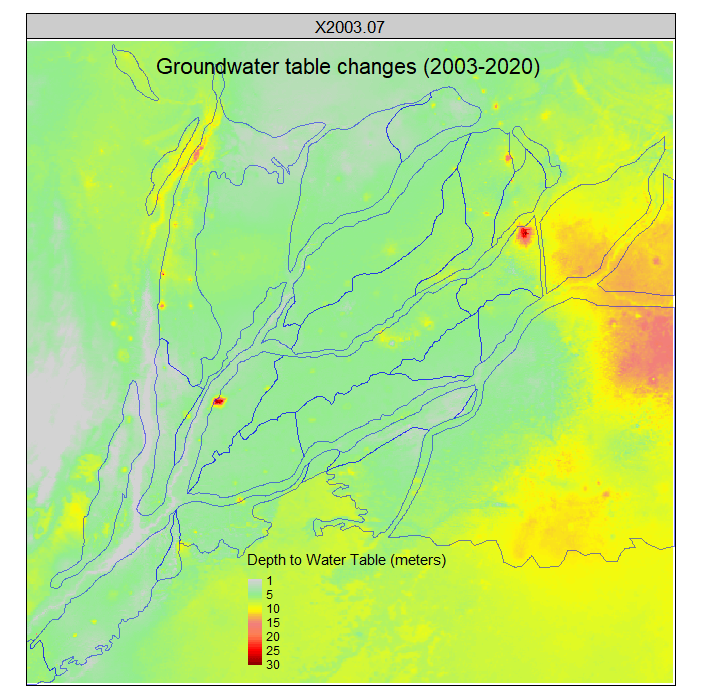
Reconstructing High-resolution Groundwater Table Data Using Machine Learning Models


bottom of page